


15 Days 14 Nights
Daily Tour
13 people
Dehradun
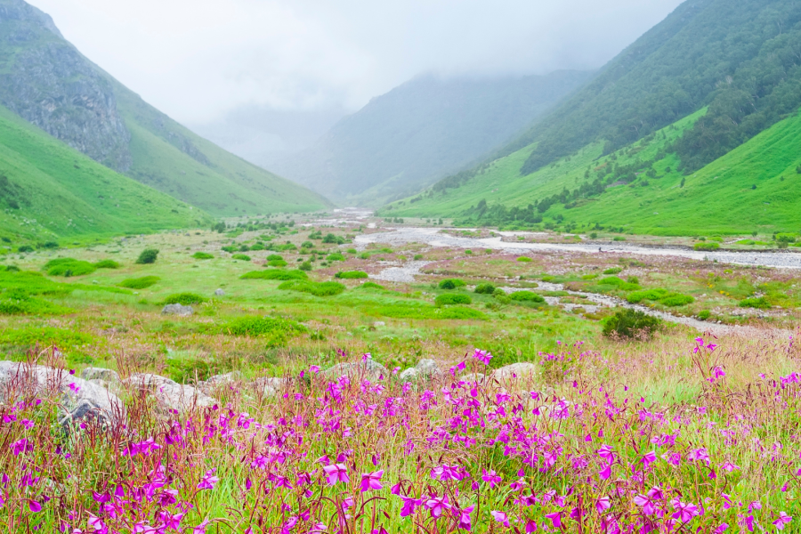
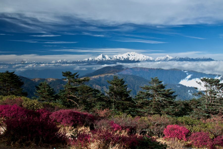
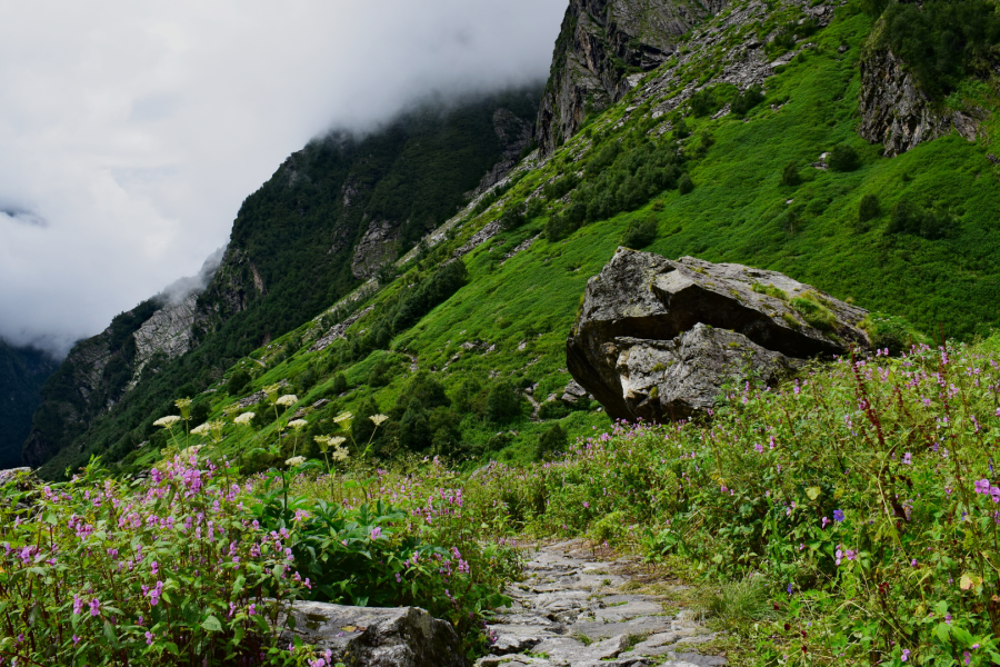
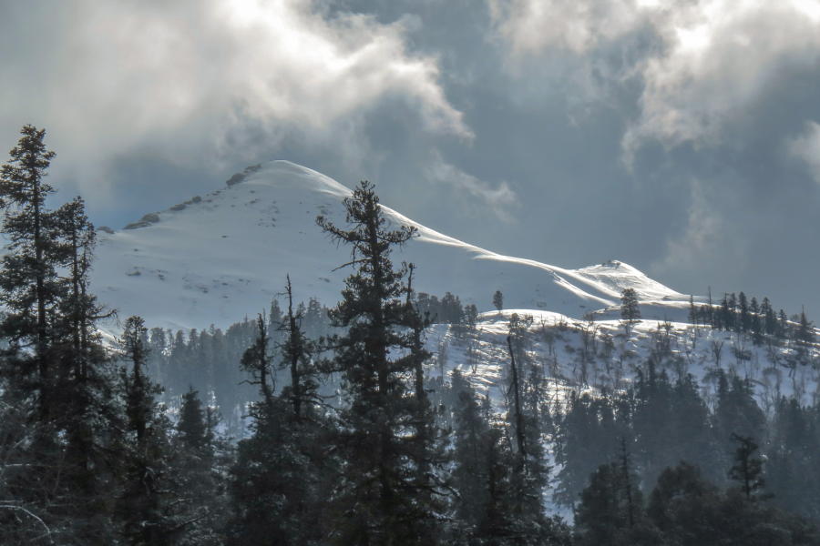
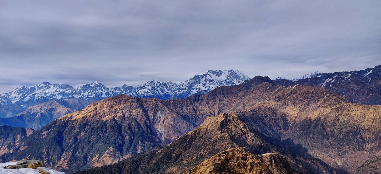
Rising majestically at an altitude of 6,387 meters (20,955 feet), Black Peak, locally known as Kalanag, is one of the most prominent summits in the Bandarpunch massif of the Garhwal Himalayas in Uttarakhand, India. Named after its resemblance to the head of a black cobra, Kalanag is a dream climb for mountaineers seeking a high-altitude adventure that is both challenging and rewarding. Nestled within the Govind Pashu Vihar National Park and Sanctuary, the expedition offers a pristine combination of lush forests, alpine meadows, glacial terrains, and breathtaking summit views of Swargarohini, Bandarpoonch, and several other Himalayan giants.
The Black Peak Expedition is more than a trek—it’s a test of endurance, skill, and spirit. Whether you are a mountaineer looking to scale a technical Himalayan peak or an adventurer pushing your limits, Kalanag offers a profound experience with nature, solitude, and achievement.
If you’re looking for a less commercial, technically rewarding Himalayan expedition, Black Peak (Kalanag) should be at the top of your list.
Why Choose Black Peak for Your Next Expedition?
• Technical Challenge: Offers mixed terrain—rock, snow, and ice—making it ideal for those wanting to advance their mountaineering skills.
• Scenic Route: From dense pine forests and gushing rivers to wide-open meadows and icy climbs.
• Cultural Immersion: Experience local traditions in remote Himalayan villages.
• Less Crowded: Unlike commercial peaks, Kalanag remains less populated, preserving its raw wilderness appeal.
Best Time for Black Peak Expedition:
The ideal months to embark on the Black Peak expedition are:
• Pre-Monsoon: May to June
• Post-Monsoon: September to early October
During these periods, the weather is relatively stable, with clear skies and firm snow conditions.
Fitness and Training Tips:
• Cardiovascular endurance (running, cycling)
• Strength training (core, legs, shoulders)
• Altitude training if possible
• Prior trekking experience above 4,500 meters is recommended
Permits and Regulations:
Being in a wildlife sanctuary and border-sensitive zone, the expedition requires:
• IMF (Indian Mountaineering Foundation) approval
• Inner Line Permit (ILP) for foreign nationals
• Local forest and park permissions
These are usually arranged by authorized trekking or mountaineering operators.
• Distance: 200 km | Duration: 8–10 hours
• Highlights: Scenic drive through Mussoorie, Yamuna Valley, and pine forests.
• Overnight Stay: Guesthouse in Sankri village
• Drive: 15 km to Gangad | Trek: 6 km
• Route: Through dense forests, crossing the Supin River multiple times.
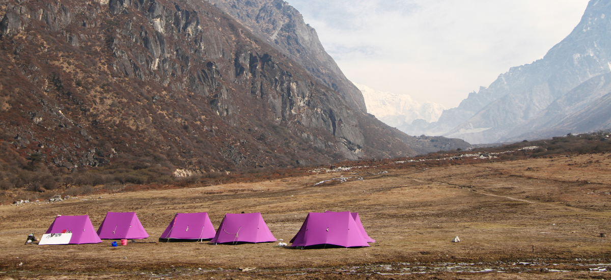
• Overnight Stay: Campsite near Seema village
• Trek Distance: 5-6 km
• Highlights: Gradual ascent through birch and rhododendron forests; first clear view of Black Peak.
• Overnight Stay: Campsite at Devsu Bugyal
• Trek Distance: 7 km
• Description: Hike through alpine meadows and glacial moraine to reach the holy Ruinsara Lake.
• Overnight Stay: Camp near Ruinsara Tal
• Activities: Acclimatization walks, basic mountaineering drills, equipment check
• Purpose: To prepare for higher altitudes and reduce AMS risk
• Trek Distance: 6 km
• Terrain: Rocky and glacial; introduction to rope work and crampons
• Overnight Stay: Base Camp
• Objective: Carry equipment and supplies to higher camp and return for proper acclimatization.
• Technique: Use of mountaineering gear in crevassed terrain
• Setup: Move fully to ABC with gear and essentials.
• Training: Practice fixed rope climbing, self-arrest techniques
• Climb Time: 4–5 hours
• Description: Final acclimatization camp before summit push; rest and hydrate well
• Start Time: Around 2 AM for alpine start
• Duration: 10–14 hours round trip
• Terrain: Steep snow slopes, crevasses, knife-edge ridges
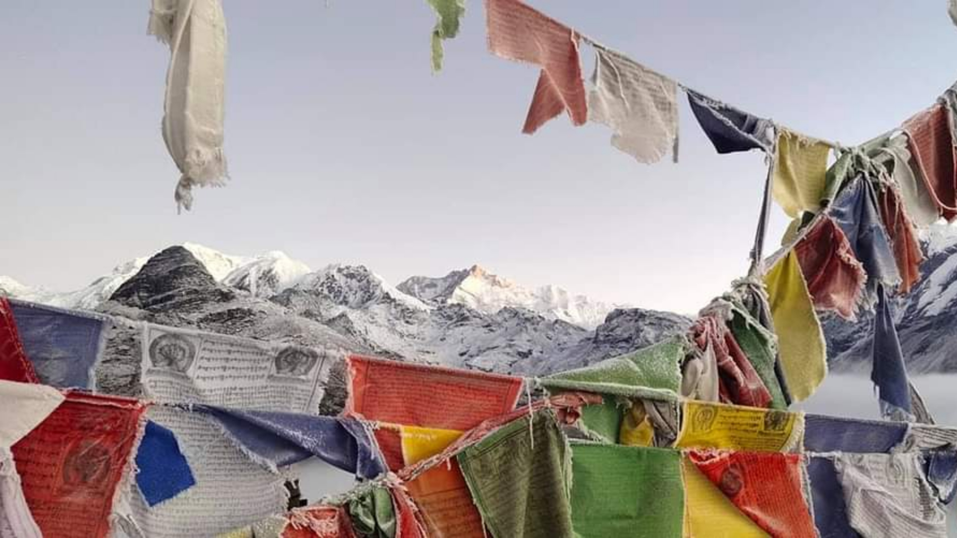
• Reward: 360° view of Swargarohini, Bandarpoonch, and the Uttarakhand Himalayas
• Purpose: Weather buffer for summit attempt
• Route: Retrace steps safely with technical descent
• Long descent: Through familiar trails, slowly transitioning from alpine to subalpine terrain
• Celebration: Return to civilization, certificate distribution
• Conclusion: End of an unforgettable Himalayan expedition
A buffer day in trekking is crucial for ensuring flexibility and safety during an expedition. It acts as a contingency for unforeseen delays due to bad weather, health issues, or challenging trail conditions. Including a buffer day helps trekkers avoid rushing, reduces stress, and increases the chances of completing the trek successfully. It also allows time for acclimatization in high-altitude regions, minimizing the risk of altitude sickness. Overall, a buffer day adds resilience to the trekking plan, making the experience safer and more enjoyable.
Kindly note: A sum of INR 3,500/- per person will be charged extra if the buffer day used.
The trek connects Kullu Valley (Parvati side) with Spiti Valley (Pin side) in Himachal Pradesh. It starts from Barshaini (near Kasol) and ends at Kaza or vice versa.
The trek is about 110 km long and usually takes 10 to 12 days, depending on weather and acclimatization.
The best time is mid-July to mid-September. Before or after this period, the trail may be blocked due to heavy snow.
It is considered a difficult and challenging trek due to its altitude (up to 17,450 ft / 5319 m), river crossings, and unpredictable weather.
Yes. This trek is not recommended for beginners. Prior experience with high-altitude treks (above 14,000 ft) and good physical fitness are essential.
Absolutely. Acclimatization is critical to avoid altitude sickness, especially since the trek crosses the high-altitude Pin Parvati Pass.
Yes, if you're trekking with an organized group or agency, nutritious meals (veg) are usually provided. At Mountbuzz, we provide 4 times vegetarian meals with Daal and Vegetable dishes that changes it's type everyday, along with Soups, and sweet dishes everyday.
Absolutely. Acclimatization is critical to avoid altitude sickness, especially since the trek crosses the high-altitude Pin Parvati Pass.
It’s not advisable to trek solo due to the remoteness, river crossings, glacier sections, and lack of mobile connectivity. Trekking with a group or guide is safer.
Yes, permits from the Forest Department and possibly Inner Line Permits (for Spiti entry) are required. Trekking with a registered agency can simplify this process.
Member Since 2023

Leave a review